

How Technology is Redefining Building Surveying: A Look at Modern Innovations | Techno Timing
The question is what are some specific examples of how technology has changed building surveying. Building surveying has experienced great changes over time because of technological innovation in this profession. Over the years, the tradition of surveying buildings hasn’t changed, but we have seen an evolution of methods and technology while surveying buildings. This article will look into some examples of how technology has improved the survey of buildings in today’s world.
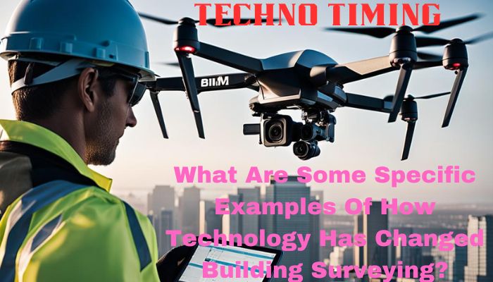
Drone Technology: A Bird’s Eye View Revolution
The use of drones was once for bird-view photography. Just like me, you see some beautiful photography with the help of drones as they have high-quality cameras. Having a drone was a hobby for kids and teenagers. Today, we use drones to survey buildings as drones capture large areas in a few minutes, which helps individuals create 3D and detailed models. Compared to old methods or tools Drones are way cheaper and save lots of time.
A few basic advantages of using drones are:
- Cover a large and difficult area
- Helps to save lots of money and labor costs
- Provide high-resolution images that help with precise mapping.
Laser Scanning: The Speed of Light in Surveying
The game changer Laser scanners are revolutionary in collecting measured data. Laser scanners survey effortlessly and provide accurate data. These devices make 3D point clouds, which help individuals to create accurate models for analysis. The laser scanning technology allows you to:
- Quick and accurate data capture
- Comprehensive detailing of structures
- Efficient creation of 3D models for various analyses
Building Information Modeling (BIM): Collaborative Digitalization
The process of using digital tools to create and plan construction projects is called BIM (Building Information Modeling). Using BIM, architects, engineers, and construction teams to work together. It supports the surveyors to survey and examine the building data thoroughly. We are mentioning 3D models here with exact measurements and notes. BIM helps to specify the A to Z of a building and it also helps with:
- Multi-disciplinary collaboration
- Data accessibility and analysis
- Lifecycle management of building data
Mobile Apps and Software: Efficiency at Your Fingertips
Specialized building surveying mobile apps have organized the process of gathering data and making reports. By handling most mundane tasks via automotive technology, these apps and software allow the surveyors to focus on other important tasks and save time.
- Streamlined data collection process
- Automated reporting features
- Increased productivity and time management
Image Recognition: The Non-Invasive Detectives
Image recognition software can examine photos and videos. After using this software it becomes easy for surveyors to find out if there’s any defect in a building or the overall condition of the building. This technology can figure out:
- Non-destructive analysis of structures
- Quick identification of potential issues
- Enhanced accuracy in defect reporting
Virtual Building Inspections: The Remote Revolution
After COVID-19, virtual tours of buildings are trending. People are inspecting the buildings from live videos. Thai allows the surveyors to continue their work while respecting the safety rules, which shows that in any crisis the industry will carry on with their job.
- Continued operations during restrictions
- Real-time collaboration between on-site and remote teams
- Adherence to health and safety guidelines
Advanced Photogrammetry Software: The Detail in the Data
Advanced photogrammetry is a software application that uses drones and ground photos to turn them into 3-D models and maps. Through those models, surveyors investigate and analyze an area and collect the data. This technology has many benefits and a few of them are:
- Accurate, detailed 3D representations
- Enhanced data for thorough analysis
- Geo-referencing for precise location context
Conclusion
The field of building surveys transformed with the era. New technologies like drones, laser scanners, BIM, mobile applications, and photogrammetry software have completely changed this field.These new technologies are helping the industry improve its old methods saving time and money, and giving useful data. However, the industry requires skilled and experienced surveyors to find solutions as we are witnessing the evolution of surveying. One thing is clear data and technology are becoming the main heroes of the world. But human skills still matter a lot as this is a human world.